Stats

Bexley

Property Prices, Crime Rates, Area & Demographic Insights.

Bexley overview

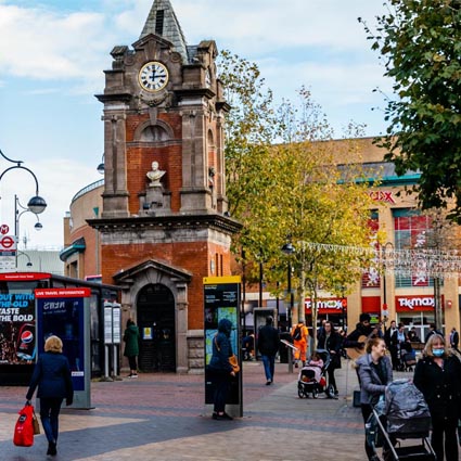
Located in South East London, Bexley offers a mix of suburban tranquillity and excellent transport links into Central London. Key areas include Bexleyheath, Sidcup, and Welling, each offering a range of housing options and local amenities. The borough is home to Danson Park, a popular green space, and the Red House, designed by William Morris. With its excellent schools and green spaces, Bexley is a sought-after area for families and commuters alike.

Bexley population and area insights and data
Price rank 44
44 of 175 areas

Rank of highest average property sale price by area

View more
Crime rank 29
29 of 175 areas

Rank of lowest average crime rate per month by area.

View more
School rank 89
89 of 175 areas

Rank of highest average rank of schools by area.

View more
Education rank 89
89 of 175 areas

Rank of highest average education level of residents by area.

View more
×

Please select an option


Sold Prices in Bexley vs National Avg

Sold Property By Type in Bexley vs National Avg

Politics in Bexley

Crime in Bexley (per 1k people)

Income & Work in Bexley

Average Household Income

Average household income icon £53,832.00

Most Popular Industry

Most popular industry icon Construction

Average Work Level

Average work level icon Lower Managerial

Employment
Most Popular Commute

car.png commuting icon Car or Van

Average Commute Distance

Average commute distance icon 10km - 19km

Average Weekly Hours Worked

Average hours worked icon 31-48 Hours

Amenities in Bexley

Most Popular Supermarket

Most popular supermarket icon The Co-operative Food

Supermarkets (per 1k people)

Most Popular Bank

Most popular bank icon Barclays

Banks (per 1k people)

GP Surgeries

Most popular bank icon 33

Opticians

Most popular bank icon 24

Dentists

Most popular bank icon 39

Age & Gender in Bexley

Education in Bexley

Religion in Bexley

Ethnicity in Bexley

Marital Status in Bexley

Sexual Orientation in Bexley

©2026 - Propertistics: UK Property & Area Demographic Statistics

Powered by TKP Technologies

Propertistics uses data provided by Ordnance Survey. © Crown copyright and database rights 2023 Ordnance Survey. All rights reserved. © Local Government Information House Limited copyright and database rights 2023. This product contains data created and maintained by Scottish Local Government. Other data including school performance and inspection data is supplied subject to the Open Government Licence v1.0 and any later versions currently in effect, via Ofsted, Department for Education, Department for Transport, Office for National Statistics and other central and local government departments. In providing search reports and services we will comply with the Search Code. For full details please read our Terms & Conditions.

Contains public sector information licensed under the Open Government Licence v1.0.

Propertistics

Log in to Propertistics

Propertistics

Forgot your details?