Stats

Bury

Property Prices, Crime Rates, Area & Demographic Insights.
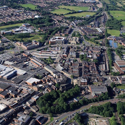
Bury overview

Located in Greater Manchester, Bury is a historic market town known for its vibrant community, strong industrial heritage, and excellent transport links. Key areas include Bury Town Centre, Radcliffe, and Tottington, offering a variety of housing options. Attractions include the famous Bury Market, The Fusilier Museum, and the nearby Jumbles Country Park. With its mix of suburban living and proximity to Manchester, Bury is an ideal location for families and professionals seeking a blend of town and countryside living.

Bury population and area insights and data
Price rank 103
103 of 175 areas

Rank of highest average property sale price by area

View more
Crime rank 129
129 of 175 areas

Rank of lowest average crime rate per month by area.

View more
School rank 83
83 of 175 areas

Rank of highest average rank of schools by area.

View more
Education rank 83
83 of 175 areas

Rank of highest average education level of residents by area.

View more
×

Please select an option


Sold Prices in Bury vs National Avg

Sold Property By Type in Bury vs National Avg

Politics in Bury

Crime in Bury (per 1k people)

Income & Work in Bury

Average Household Income

Average household income icon £42,535.00

Most Popular Industry

Most popular industry icon Retail Trade

Average Work Level

Average work level icon Lower Managerial

Employment
Most Popular Commute

car.png commuting icon Car or Van

Average Commute Distance

Average commute distance icon 5km - 9km

Average Weekly Hours Worked

Average hours worked icon 31-48 Hours

Amenities in Bury

Most Popular Supermarket

Most popular supermarket icon The Co-operative Food

Supermarkets (per 1k people)

Most Popular Bank

Most popular bank icon Barclays

Banks (per 1k people)

GP Surgeries

Most popular bank icon 46

Opticians

Most popular bank icon 29

Dentists

Most popular bank icon 30

Age & Gender in Bury

Education in Bury

Religion in Bury

Ethnicity in Bury

Marital Status in Bury

Sexual Orientation in Bury

©2026 - Propertistics: UK Property & Area Demographic Statistics

Powered by TKP Technologies

Propertistics uses data provided by Ordnance Survey. © Crown copyright and database rights 2023 Ordnance Survey. All rights reserved. © Local Government Information House Limited copyright and database rights 2023. This product contains data created and maintained by Scottish Local Government. Other data including school performance and inspection data is supplied subject to the Open Government Licence v1.0 and any later versions currently in effect, via Ofsted, Department for Education, Department for Transport, Office for National Statistics and other central and local government departments. In providing search reports and services we will comply with the Search Code. For full details please read our Terms & Conditions.

Contains public sector information licensed under the Open Government Licence v1.0.

Propertistics

Log in to Propertistics

Propertistics

Forgot your details?